• Skip to primary navigation
  • Skip to main content
  • Skip to primary sidebar
Brownie Bites Blog
  • Home
  • Food
    • Recipes ->
      • Low Carb and Keto
      • Bars & Barks
      • Beverages
      • Cakes & Pies
      • Candy
      • Cookies & Cupcakes
      • Copycat & Pop Culture
      • Dog Treats
      • Entrees
      • Ice Cream & Frozen
      • Muffins & Breads
      • Starters & Sides
    • Restaurant Tours
    • Party Ideas
    • Tips and Tricks
  • Travel
    • View All
    • California
    • Camping & RV Life
    • Disney ->
      • Bahama Cruise
      • Disney World
      • East Caribbean Cruise
      • West Caribbean Cruise
    • Hawaii
    • Hiking
    • Hotel Tours
    • Japan
    • Seaside Florida
    • Smoky Mountains
    • Washington DC
  • Reviews & Unboxings
    • View All
    • Candy & Sweets
    • Nut Butters
    • Nutrition Bars
    • Snacks
    • Specialty Food
    • Subscription Boxes
  • About
    • About Me
    • Contact
menu icon
go to homepage
search icon
Homepage link
  • Home
  • Recipes
  • Travel
  • Reviews
  • About Me
    • Facebook
    • Instagram
    • Pinterest
    • RSS
    • Twitter
  • ×

    Vacation » Hiking » Hike to Siler's Bald

    Hike to Siler's Bald

    Posted: 05/31/2012 | Last updated: 08/17/2015 by Erin 1 Comment
    Post may contain affiliate links via Amazon Associates or other programs. (Disclosure)

    • Facebook
    • Twitter

    Yay for more hiking!  This time we set our sights on...

    Siler's Bald

    Roundtrip: 9.3 miles (we went a bit farther than that because we also took a side jaunt up to Clingman's Dome)
    Total Elevation Gain: 2,152 ft (again, it'll be more if you go to Clingman's)
    Directions: From the Sugarlands Visitor Center near Gatlinburg, drive 13.2 miles south along Newfound Gap Road.  Turn right onto Clingmans Dome Road and go 7 miles to the end of the road  to a large paved parking lot.  At the far end of the lot is a forked trailhead.  Take the left, unpaved trail to begin your journey.

    scrambled egg sandwich
    Starting this crazy hike off right - egg sammich, coming right up!

    Smoky Mountains Hike to Siler's Bald
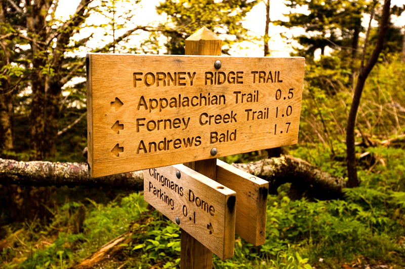
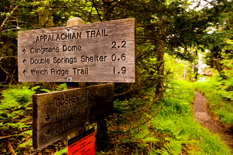
    The trail starts at the parking lot for Clingman's Dome.

    Smoky Mountains Hike to Siler's Bald
    You can either fork off to the left toward Siler's Bald (you'll connect with the AT first), or you can take the paved trail to the right that will take you to the Clingman's lookout tower.

    Smoky Mountains Hike to Siler's Bald
    The first part of the trail had many interesting features.  Definitely one of the more diverse trails we've seen.

    Smoky Mountains Hike to Siler's Bald

    Smoky Mountains Hike to Siler's Bald
    There was a THICK cloud cover that blocked most of the areas that would have provided us with a view.  No worries, though, the creepy atmosphere was fun!

    Smoky Mountains Hike to Siler's Bald
    Each time we hit the trails, we see more and more color.

    Smoky Mountains Hike to Siler's Bald

    Smoky Mountains Hike to Siler's Bald
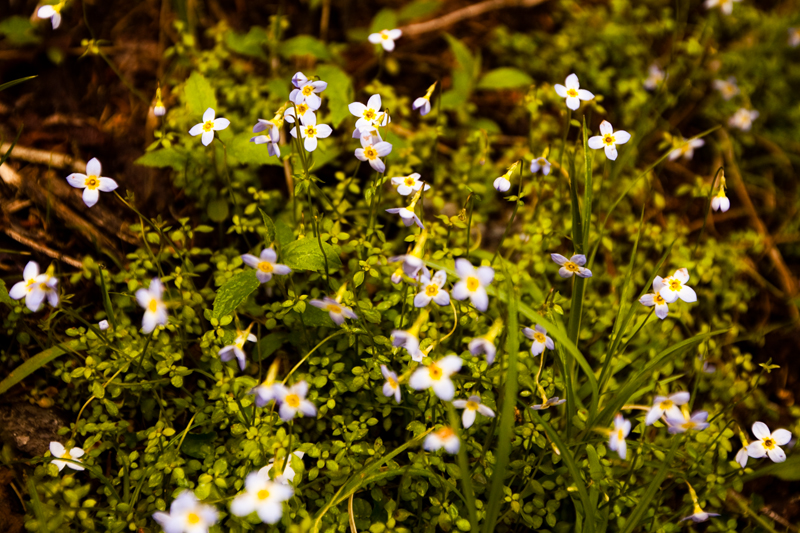
    Our first little friend on this trek.

    Smoky Mountains Hike to Siler's Bald

    Smoky Mountains Hike to Siler's Bald

    Smoky Mountains Hike to Siler's Bald
    So creepy.. the diseased trees just added to the creep factor!

    Smoky Mountains Hike to Siler's Bald
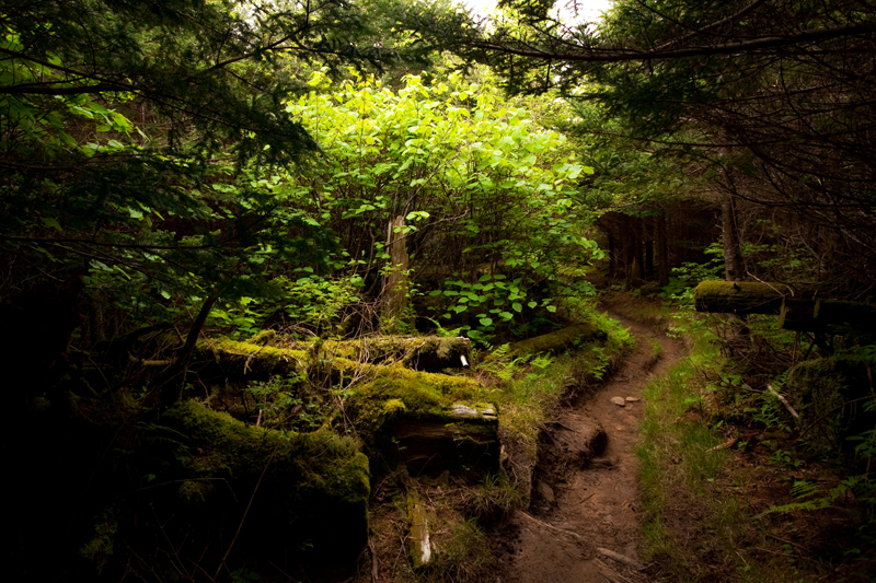
    The heavy tree cover combined with the thick clouds made this one of the darkest hikes we've taken.

    Smoky Mountains Hike to Siler's Bald

    Smoky Mountains Hike to Siler's Bald

    Smoky Mountains Hike to Siler's Bald
    Second little friend near the AT shelter!

    Smoky Mountains Hike to Siler's Bald
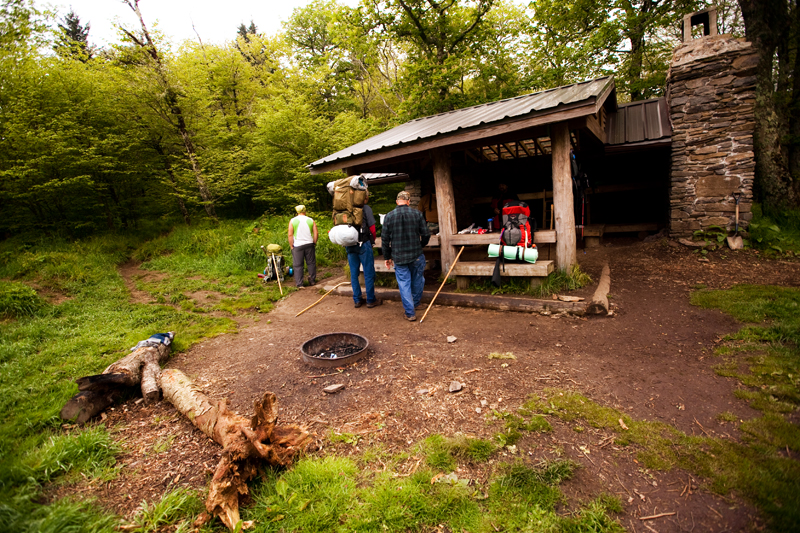
    Thru hikers taking a rest at the shelter.

    Smoky Mountains Hike to Siler's Bald
    More creepiness!

    Smoky Mountains Hike to Siler's Bald
    Mountain ferns!

    Smoky Mountains Hike to Siler's Bald
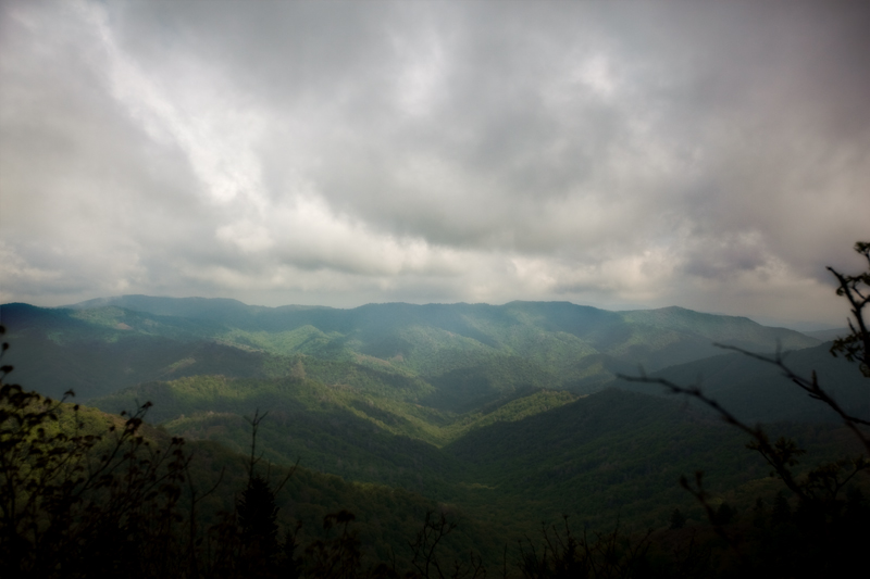
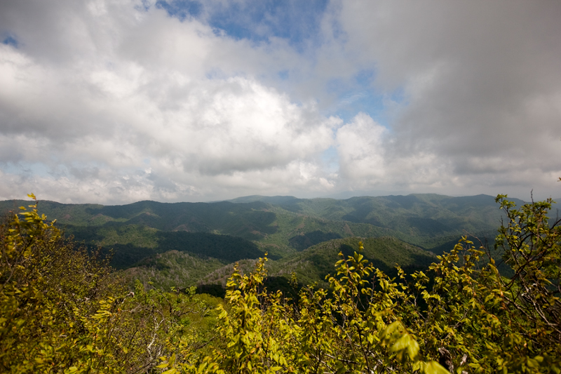
    We finally reached an opening where the cloud cover lifted a bit.

    Smoky Mountains Hike to Siler's Bald

    Smoky Mountains Hike to Siler's Bald
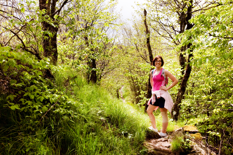
    Rockin the knee brace.  This trail KILLED my IT Band.  Killed it.  I couldn't walk for the rest of the evening, ugh.

    Smoky Mountains Hike to Siler's Bald
    At the top you'll find this rock..

    Smoky Mountains Hike to Siler's Bald
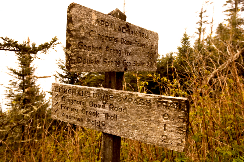
    With this U.S. Geological Survey marker.  If you hang a left here, you'll continue along the AT.  If you go straight ahead, you'll reach a great lunch spot overlooking Miry Ridge.  The bald itself is no longer maintained, so it's overgrown and not an open meadow like Gregory Bald

    Smoky Mountains Hike to Siler's Bald
    See?  Pretty neat place to have lunch.  There's even a few convenient rocks to use as a place to sit.

    Smoky Mountains Hike to Siler's Bald
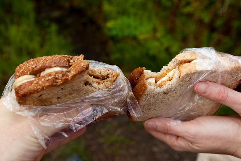
    The usual trail lunch.

    Smoky Mountains Hike to Siler's Bald
    Requisite photo #1

    Smoky Mountains Hike to Siler's Bald
    Requisite photo #2

    Smoky Mountains Hike to Siler's Bald
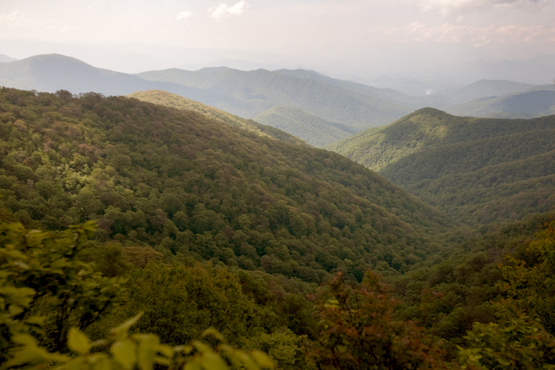
    This was most of the way back.. it was odd to have so much of the ground visible on a nearby hillside.  This is looking toward Clingman's Dome.

    Smoky Mountains Hike to Siler's Bald
    On the way back, you have the option to fork off to the left on a semi-hidden trail that will connect you with the paved trail to Clingman's Dome.  We chose to take that route and came across this great little lookout point.

    Smoky Mountains Hike to Siler's Bald

    Smoky Mountains Hike to Siler's Bald
    We weren't going to come all this way and not take a little side trip to the Clingman's Dome Tower!

    Smoky Mountains Hike to Siler's Bald
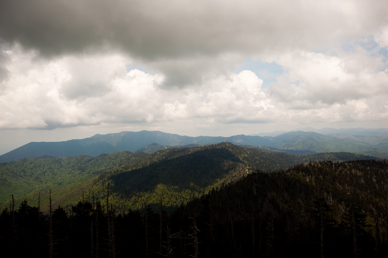
    360 degree views at the top.  Still pretty cloudy, but it was still very pretty!

    Smoky Mountains Hike to Siler's Bald

    Smoky Mountains Hike to Siler's Bald
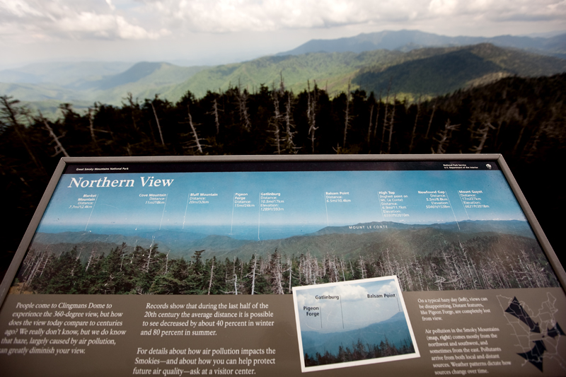
    On each side of the tower, there is a sign that tells you what you can see.

    Smoky Mountains Hike to Siler's Bald
    Looking down at the iconic spiraling ramp to the top.

    We were pretty wasted when we got back to the car.  I dunno if it's the fact that wedding season is in full bore and we're exhausting ourselves shooting, or if it really was that gnarly of a hike.  I'm thinking it's a little bit of both - this trail is not for the faint-hearted.. if you want a workout, this one will do it!

    Related posts:

    1. Hike to Gregory Bald (and other stupid things people do to see a flower)
    2. Hike to Mt. Cammerer Fire Tower
    3. Hike to Rainbow Falls
    4. Hiking the Lumber Ridge Trail
    « Vanilla Cupcake Comparisons | Which is Best?
    Anniversary Dinner at Naples Italian Restaurant »

    About Erin

    Erin is a mom of two human babies and two fur-covered babies. She loves comfy clothes, eats too much peanut butter, and watches excessive amounts of Netflix. Make her day and toss her a like on Facebook or follow her on Instagram. Post may contain affiliate links including those via the Amazon Associates program

    Reader Interactions

    Comments

    1. Remi

      June 03, 2012 at 11:16 am

      These hiking posts are killing me.
      Literally. I am writing this post-mortem. 
      Must get to mountains. Stat. 

      Reply

    Say Something About This Post: Cancel reply

    Your email address will not be published. Required fields are marked *

    Primary Sidebar


    Hi, I'm Erin! I love food and I bet you do, too! I cook for my family and share the recipes that we love. We also like to camp, so there will be a fair bit about that around here, too.

    Let's Be Friends

    • Facebook
    • Instagram
    • Pinterest
    • RSS
    • Twitter

    Recent Recipes

    Disney Trip Reports

    More Disney Posts

    Footer

    ? back to top

    About

    • About Me
    • Privacy Policy
    • Disclosure & Terms
    • Sweepstakes Terms

    Newsletter

    • Sign Up to be notified of new posts

    Contact

    • Contact

    As an Amazon Associate I earn from qualifying purchases.

    Copyright © 2021 Foodie Pro on the Foodie Pro Theme